

Hurricane Helene is likely to form tonight or tomorrow, initially targeting Florida before setting its sights on the Southeast.
Hurricane Watches and Storm Surge Watches are up from Apalachicola to Tampa.
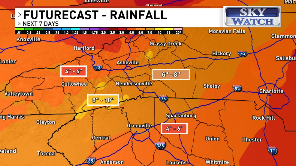
In the Western Carolinas, the current forecast track predicts significant rainfall, with several inches expected to accumulate on Thursday and Friday. This could lead to possible flooding and flash flooding.
Additionally, waves of heavy rain could begin Wednesday evening and night along a stalled frontal boundary.
Residents are advised to start preparing now by clearing downspouts, drains, and ditches of debris. Those living in flood-prone areas should be ready to move quickly to higher ground if a flash flood warning is issued.
Thursday and Friday will be Weather Warn Days due to heavy rain, causing possible flash flooding and mudslides.
In addition, winds from 35 to 50 mph on Friday could topple some trees causing power outages, especially on higher ridgetops.
STORY & PHOTO COURTESY OF ABC 13 WLOSHelene could bring heavy rain, possible flooding to Western Carolinas (wlos.com)